Role of software in the antidrone system
Software algorithms employing a neural network play a crucial role in the Kaspersky Antidrone system. They allow you to build a customizable and effective detection and mitigation system for any facility while providing the capabilities for scaling and upgrades in the future. The software used improves the accuracy of drone classification, reduces false positives, and gives the system operator time to analyze the situation and make a decision.
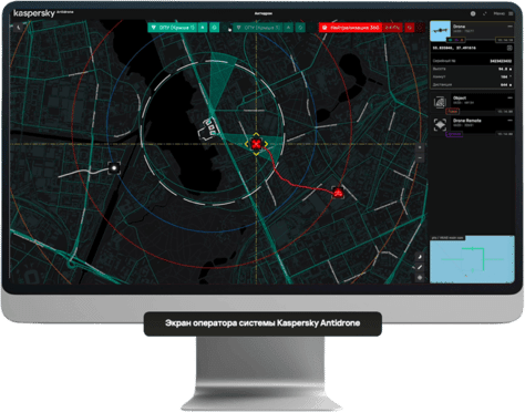


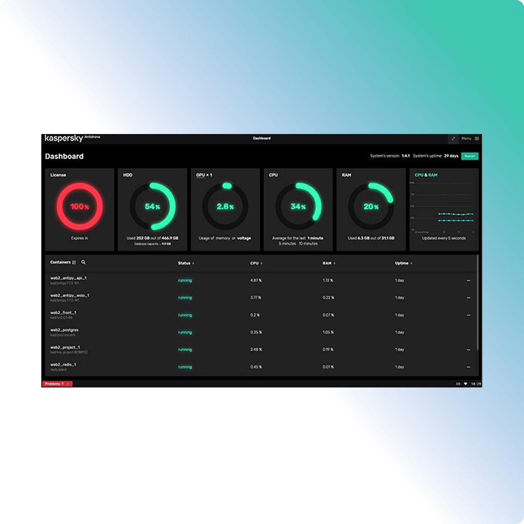
Intuitive interface
State-of-the-art UAV detection applications have a complex control interface and require the operator to have certain technical knowledge. Data overload increases the reaction time and, consequently, increases the impact from human error and the risk of missing a drone.
Kaspersky experts are proposing a completely new approach to data visualization in anti-drone systems. Monitoring the airspace around your facility will be as easy as using a car navigation system.
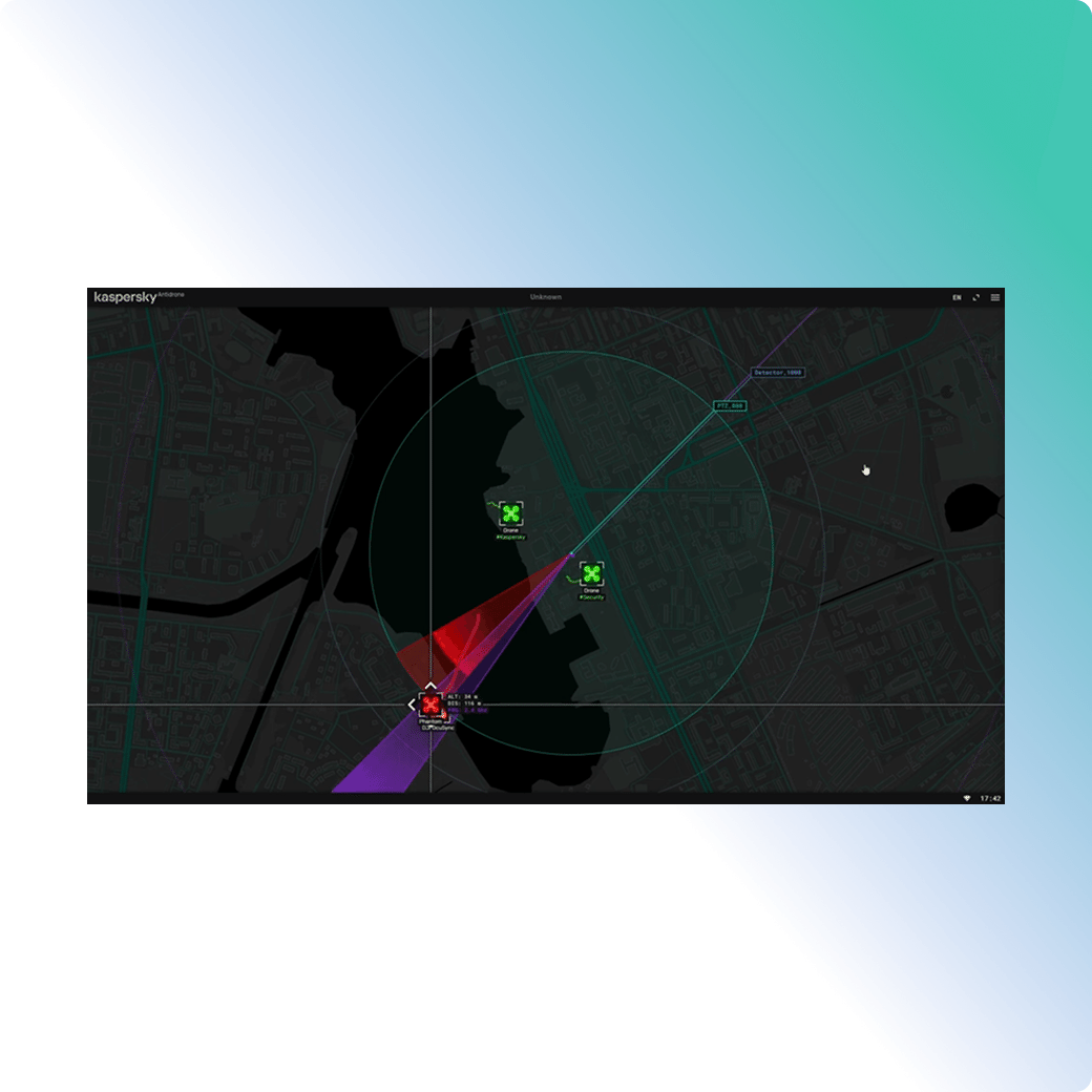

Artificial intelligence (AI) and neural networks
The Kaspersky Antidrone detection and monitoring system uses a neural network developed by Kaspersky programmers. It enables PTZ cameras classify and track drones (including custom-built UAVs). This neural network is used exclusively within the Kaspersky Antidrone system. An improved version of the neural network was released in 2024. Its recognition quality and performance increased by 10% on average.
System requirements
- Operating system 22.04 LTS
- Latest version of NVidia driver